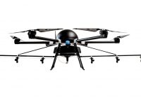
EHang has announced its participation in the European Union “GOF 2.0 Integrated Urban Airspace Validation” project, which is a follow-up to the SESAR JU GOF U-space project. GOF 2.0 is focused on developing the safe, secure, and sustainable integration of unmanned aerial vehicle (UAV) operations in urban airspace. As one of the 13 consortium members and the leading passenger electric vertical takeoff and landing (eVTOL) company, EHang is expected to ensure safe flight operations in…
Read MoreUAV
Drone Delivery – Is It A Good Idea?
You’ve likely heard a lot of talk about using drones to deliver everything from blood to seeds. But is it actually a good idea? Today we take a look at some of the pros and cons of this new industry and try and see if it’s really worth it. The company Zipline currently airdrops critical blood and other medical supplies with over 500 packages being delivered per day, rain or shine, 24/7 at up to 75…
Read MoreCOPTRZ to Supply Specialist UAVs Equipped Thermal Imaging Capabilities Devon & Cornwall Police and Dorset Police
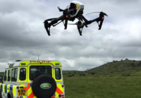
COPTRZ have been announced as the exclusive supplier of UAV solutions to Devon & Cornwall Police and Dorset Police. The force will be expanding their fleet in the coming months with the purchase of a range of specialist UAVs equipped with optical zoom and thermal imaging capabilities. Earlier this year Devon & Cornwall Police and Dorset Police were the first force to announce their intentions to employ full-time UAV pilots and create a dedicated drone unit. Investment in the…
Read MoreDrone Zone: What Are The Benefits of Drones?
There is little doubt that the revolution in aerial vehicle technology in the form of drones – otherwise known as Unmanned Aerial Vehicles (UAVs) or Unmanned Aerial Systems (UASs) – is causing a re-think when it comes to public safety and security, especially in the uncertain world we live in. Whilst much attention is being given in the media to countering the threat posed by drones should they stray too close to sensitive sites like…
Read MoreDJI M200 Series Drones For Aerial Data Collection
DJI, the world leader in unmanned aerial technology, has unveiled the new Matrice 200 drone series (M200), which is purpose-built for professional users to perform aerial inspections and collect data – making drone technology an affordable and easy-to-use tool for enterprises that recognise how aerial imaging can transform their operations. The M200 series’ folding body is easy to carry and easy to set up, with a weather- and water-resistant body, ideal for field operations. It…
Read MoresenseFly and AirMap partner to advance safety for commercial drones
New partnership delivers robust airspace intelligence and unmanned traffic management solutions to senseFly’s largely autonomous commercial drones senseFly, the world’s first choice producer of mapping drones and subsidiary of Parrot Group, today announced that they have partnered with AirMap, the world’s leading airspace management platform for drones, to deliver AirMap’s airspace services to senseFly’s eBee fixed wing drones and Albris quadcopter. AirMap’s airspace platform services will be directly integrated into senseFly’s eMotion flight and data…
Read MoreDOT and FAA Finalize Rules for Small UAS
The Department of Transportation’s Federal Aviation Administration has finalized the first operational rules (PDF) for routine commercial use of small unmanned aircraft systems (UAS or “drones”), opening pathways towards fully integrating UAS into the nation’s airspace. These new regulations work to harness new innovations safely, to spur job growth, advance critical scientific research and save lives. “We are part of a new era in aviation, and the potential for unmanned aircraft will make it safer and easier…
Read MoreDrone captures latest expansion progress at Anfield
Liverpool FC has released new footage showing Anfield’s Main Stand expansion from the sky.
Read MoreSnap. Serious technology in a lean design.
Cutting Edge Camera We spared no expense with Sony Exmor IMX 377 1 / 2.3” camera sensor and the best processor money can buy. Top quality video doesn’t come cheap, but we think it’s worth it. Smart Battery Our battery keeps track of exactly how much charge it has left and even learns over time so it always knows exactly how much range you’ve got. Then we fuse this with GPS data to create what…
Read MoreImiTec and Drone Ops Ltd announce UAV collaboration
Bristol based radiation mapping company, ImiTec Limited, and Newcastle based Drone Ops Limited, have announced a new collaboration for the provision of Small Unmanned Aerial Systems services. Droneops will be supporting ImiTec in the finals of the $1m United Arab Emirates’ Drone for Good competition which is being held in Dubai on 4 to 6 February 2016. ImiTec’s patented UAV based Advanced Autonomous Radiation Monitoring system can deliver low-altitude aerial meter resolution maps of radiation…
Read More
